
The Woodlands Neighbors by Parcel
For a block-level search, the Township parcel layer is the best starting point. It can show which mapped parcels touch or fall near a chosen parcel, then supply stable identifiers and geography for comparison. The result is a map-defined set of properties, not a list of people who know one another. The following sources each answer a different block question and each has limits on what it can prove about your The Woodlands neighbors.
| Block source | What it can show around one parcel | Access path |
|---|---|---|
| Township PARCELS FeatureServer | Geometry, PID or ParcelID, address, ZIP, village, and legal description | Online spatial query and feature service |
| MCAD or HCAD | Appraisal and owner-context fields for the appropriate county | Online property search, counter, or custodian |
| BNDRYwithSTREETS MapServer | Street centerlines, boundaries, parcels, water, and common-area clues | Township map service and gallery |
| ASSOCIATIONS FeatureServer | Association or covenant geography over a parcel area | Online overlay, with field details to verify |
| Village associations and elections | Public civic organization information, not a membership census | Township village and Residential Elections pages |
An owner field, mailing address, or association polygon does not prove present occupancy. The research did not retain an individual parcel sample, so no names or house numbers are asserted here. If a task needs the complete record trail for a named street, the The Woodlands streets reference follows the address route in more detail.
Define The Woodlands Neighbors Spatially
Choose the map relationship before running a query. A shared boundary finds properties that touch the subject parcel. A distance query finds parcel geometry within a stated radius. A street-segment method treats properties on a defined road segment as the comparison group, while a subdivision method follows the recorded development area. Record the method, distance or relationship, layer used, date checked, and number of returned geometries. Without those details, "neighbor" is too loose to reproduce.
- Locate the subject parcel and retain its PID or ParcelID and legal description.
- Set one spatial relationship, such as shared boundary or a documented distance.
- Query the surrounding parcel geometries and record the result count before reading attributes.
- Compare village, ZIP, and county context, then cross-check public ownership context with MCAD or HCAD.
Parcel geometry can bring in a greenbelt, road, creek, lake, common area, or village-boundary parcel. Such adjacency may be correct on a map but does not mean it shares a normal residential street relationship. That distinction is especially useful in The Woodlands, where water and common-area features can interrupt an apparent block.
The Woodlands Parcel Query Fields
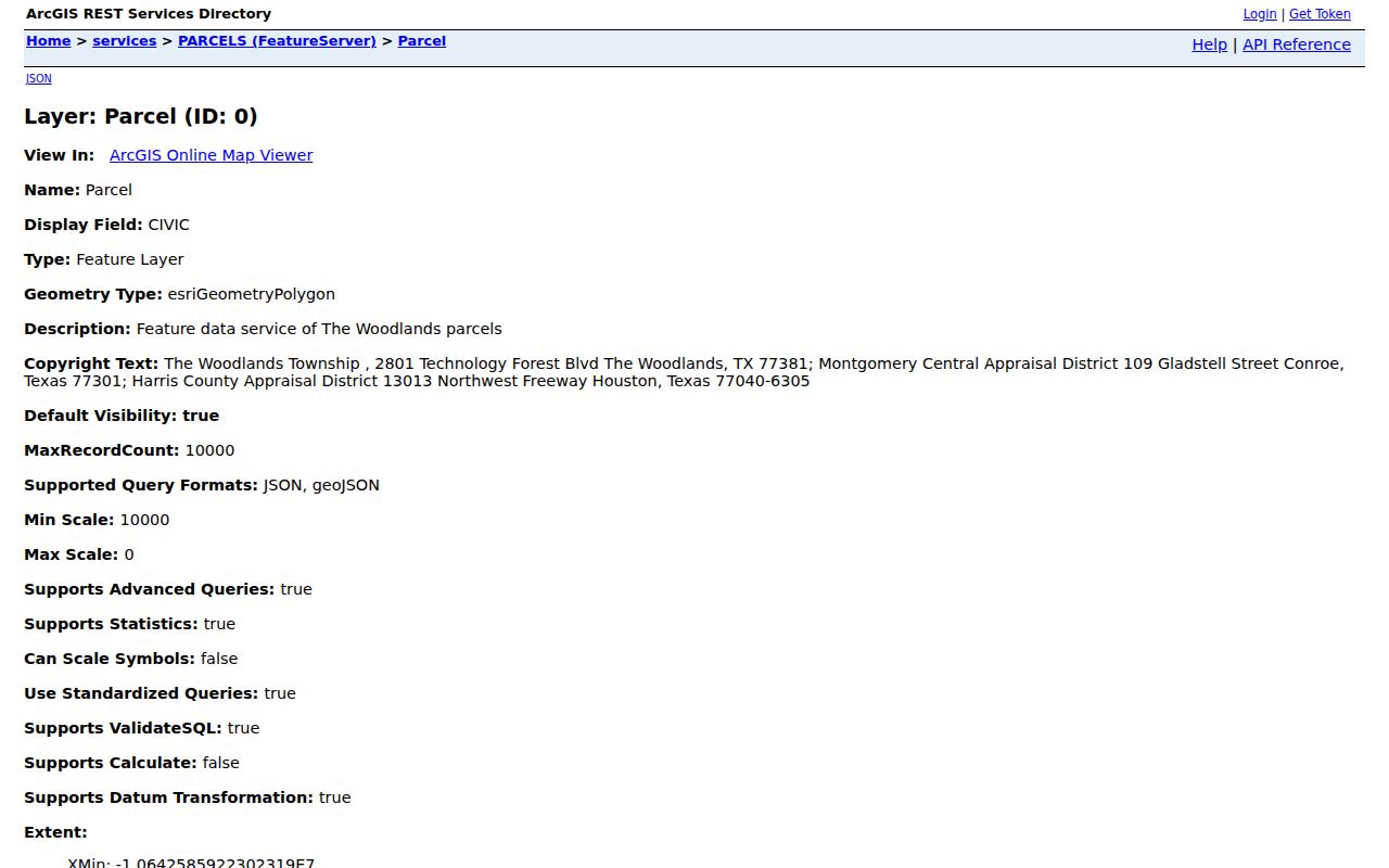
The official Township PARCELS FeatureServer supports attribute and spatial queries, GeoJSON output, pagination, and a maximum record count of 10,000. Its useful fields include PID, ParcelID, formatted address, ZIP code, subdivision, village, section, block, lot, tract, legal-description text, association numbers, plat or replat dates, appraisal-district information, and map coordinates. The legal description often survives a street-name mismatch and gives a stronger join than a casual address search.
The Township parcel-field display shows the type of location and legal-description attributes available for a The Woodlands neighbors search.
Ownership-name and mailing-address attributes may be returned by the layer. Treat them as a GIS snapshot, apply suppression rules, and reconcile the county context before relying on them. MCAD serves Montgomery County; Creekside Park calls for Harris County appraisal and clerk systems instead.
Note: The service's maximum count does not turn a broad query into a complete people directory or an occupancy record.
The Woodlands Map Barriers
The BNDRYwithSTREETS MapServer adds Street Centerline, Thoroughfare Centerline, Creek or Branch or Stream, Parcel, Lake or Pond or Wetland, The Woodlands Area, and Township-boundary layers. These layers help test whether two parcels are adjacent only because they meet at water, a road, or a common area. A map result is strongest when it says exactly what it measured instead of turning every nearby parcel into a personal connection.
The Township map gallery is the official visual route for these geographic resources.
This is a practical local quirk: water, trails, roads, and common property can appear next to a home in GIS without forming a normal block. Preserve the street and boundary layers with the parcel query so a later reader can understand the result set.
The Woodlands Association Overlays
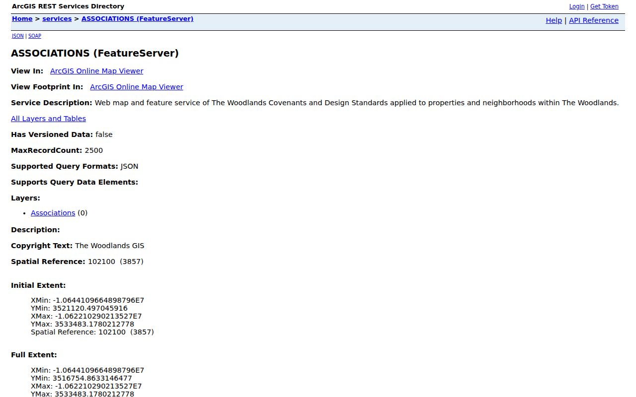
The ASSOCIATIONS FeatureServer describes association and covenant areas that apply to properties or neighborhoods. It supports queries and has a 2,500-record maximum. The research did not capture its complete attribute list, so an association code or layer field should be checked directly before it is used. The overlay identifies formal geographic coverage, not a social tie, membership roster, or contact list for The Woodlands neighbors.
The Township association service is shown below as the record route for covenant geography.
For association paperwork, the Texas HOA Management Certificate Search can be filtered by association name, county, city, ZIP, and type. Its data is user-submitted and the state warning says completeness and reliability are not guaranteed. Use it to locate an association record, then verify with the association, Township, and parcel geography.
Map The Woodlands Neighbor Parcels
Use one repeatable flow: address to parcel, parcel to documented spatial relationship, nearby geometries to identifiers, then identifiers to the correct county appraisal context. Do not start by collecting names. The query should first define the physical group, then show why each returned parcel belongs in it. A parcel's legal description, subdivision, section, block, and lot can resolve a failed street-name search and preserve the connection between the map and a recorded instrument.
For a detailed address chain across a whole street, the street route is more appropriate than a block query. The block method remains narrow: it answers which mapped parcels satisfy the chosen relationship at the time the layer was checked.
The Woodlands Neighbor Record Access
Online sources are the first route for parcel, boundary, association, and appraisal context. When a map field, historical layer, permit activity, or association record is not publicly visible, use the channel held by the actual custodian. Township map and public-information questions can be taken to Township offices or its written-request process. Appraisal questions belong with the relevant appraisal district, and deed or plat questions belong with the County Clerk. A Creekside parcel may shift that route to Harris County.
The Township Public Information Request page uses JustFOIA and lists online, mail, email, and in-person submission for existing Township-held records. State law requires the request in writing. Identify the layer, map date, parcel or area, and format sought, then keep the reference number. The Township cannot compel MCAD, HCAD, or an independent association to produce records they hold separately.
For older context, MCMLS has maps and local-history material, while TSLAC microfilm and County Clerk plat or deed research can help follow a legal description over time. Phone, mail, and counter procedures vary by custodian, so confirm current hours and copy rules before travel or ordering records.
The Woodlands Village Context
The Township's Village Associations page identifies eight named villages and points to their local associations. Most are independent, resident-led organizations, so access to association-held material differs from association to association. Township-held records can be requested through the public-information process; that does not require an independent organization to provide a private roster.
| Village or area | County or boundary note | Record context |
|---|---|---|
| Alden Bridge, Cochran's Crossing, College Park | Montgomery County | Village page, covenant area, Township GIS |
| Creekside Park | Harris County | Use Harris appraisal, clerk, court, and election routing where required |
| Grogan's Mill, Panther Creek, Sterling Ridge | Montgomery County | Village, covenant, election, and parcel context |
| Indian Springs | Split by Falconwing Drive | Determine the east or west side before checking WCA or TWA context |
The Township village-association page provides the address-based community context.
Residential election results can identify candidates or officeholders in a public civic role, but they are not a census of the people living in a village. A village name is a helpful map clue, not a substitute for a parcel query.
The Woodlands Neighbor Tools Compared
Official map and appraisal records have a defined custodian and stated purpose. Commercial neighbor-search tools may combine sources, but their update date, matching method, and coverage can be unclear. Neither category proves present occupancy or a relationship between people. For a careful search, keep the official record type, source date, geography, and limitations beside every result rather than merging them into a single claim.
| Source category | Useful for | Important limit |
|---|---|---|
| Official spatial and appraisal records | Parcel geometry, legal context, and county-specific ownership snapshots | Not proof of who is present or socially connected |
| Association and civic sources | Formal area, public roles, or association contact routes | Availability differs and does not create a membership directory |
| Commercial neighbor tools | Category-level leads that need independent checking | May be incomplete, stale, or unclear about source and matching method |
The Woodlands Neighbor Privacy Limits
Texas voter records have address-confidentiality rules. State guidance explains web suppression, county confidentiality for qualifying victims, the Attorney General Address Confidentiality Program, and DPS alternate-address protections for eligible people. SSNs and driver-license or identification information are confidential. Do not use a second source to undo an address protection, and do not copy protected data from a public-facing field simply because the field can be viewed.
Renter names, household composition, utility use, delivery information, and private contact details are not supplied by this parcel workflow. A historic address, a voter result, a mailing field, or an association area is not proof of current residence. If an official record appears wrong, contact the office that holds it and retain the source date rather than spreading the error.
Lawful use. Use The Woodlands neighbors information for personal, lawful neighborhood context, family-history work, or civic curiosity. Do not use a parcel map or record result to watch, stalk, harass, intimidate, or harm another person.